Template:Central Deccan Plateau dry deciduous forests
Central Deccan Plateau dry deciduous forests
Published: May 8, 2014
Author: World Wildlife Fund
Contributing Author: C. Michael Hogan
Contributing Author: Saurabh Agrawal
Topic Editor: Mark McGinley
The Central Deccan Plateau Dry Deciduous Forests comprise a sizeable ecoregion in central India that is neither exceptionally species-rich nor high in numbers of endemic species; however, the ecoregion holds approximately twenty percent of its natural habitat as several large blocks, some of which exceed 5000 square kilometres (km2). In a region characterized by a relatively high human population density and the presence of several large vertebrate species, the existence of large natural habitat areas is both unusual and important. These large habitat blocks have been recognized as high-priority landscapes for a long-term tiger conservation strategy; therefore, the ecoregion is an important geographic element of the regional Royal Bengal Tiger conservation strategy.
Location and General Description
 World Wildlife Fund and Encyclopedia of Earth
The Central Deccan Plateau dry deciduous forests ecoregion represents the Hardwickia-dominated woodlands in the central Deccan Plateau, a vegetation type that is distinct from the Teak (Tectona grandis) or Sal (Shorea robusta) dominated dry forests that cover most of the Deccan Plateau. The ecoregion extends across much of the central Indian states of Madhya Pradesh, Maharashtra, Karnataka, and Andhra Pradesh. It includes the western portion of the Satpura Mountain Range within the northern extent of this ecoregion. The Godavari River, which rises in the Western Ghats, crosses the ecoregion as it traverses the Deccan Plateau.
The Deccan Plateau itself traces its geological history back to Gondwanaland. A Miocene era fossil flora of evergreen rainforest genera including Anisopteris, Cynometra, Dipterocarpus, Dryobalanops, Gluta, Hopea, and Mesua reveals the past moist climatic history.
Biodiversity Features
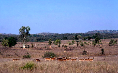
.jpg) Gaur (Bos gaurus), India. Source: Ranjit Talwas Structurally, the dry deciduous forests in this ecoregion have an upper canopy at 15 to 25 metres (m) and an understory at 10 to 15 m. Lianas drape the trees in mature forests, but the undergrowth is sparse. The characteristic tree association is Hardwickia binata-Albizia amara woodland with Tectona grandis, Boswellia serrata, Lannea coromandelica, Anogeissus latifolia, Albizia lebbek, Lagerstroemia parvifolia, Diospyros tomentosa, and Acacia catechu in the northern areas and Pterocarpus santalinus, P. marsupium, Chyloroxylon swietenia, Terminalia chebula, T. tomentosa, Albizia lebbek, and Dalbergia latifolia in the southern areas of the ecoregion. The Nagarjunasagar-Srisailam Tiger Reserve in Andhra Pradesh represents the typical habitat in this ecoregion. Several sacred groves containing evergreen forests in the state of Andhra Pradesh make an important contribution to conservation and to the ecoregion's diversity.
Gaur (Bos gaurus), India. Source: Ranjit Talwas Structurally, the dry deciduous forests in this ecoregion have an upper canopy at 15 to 25 metres (m) and an understory at 10 to 15 m. Lianas drape the trees in mature forests, but the undergrowth is sparse. The characteristic tree association is Hardwickia binata-Albizia amara woodland with Tectona grandis, Boswellia serrata, Lannea coromandelica, Anogeissus latifolia, Albizia lebbek, Lagerstroemia parvifolia, Diospyros tomentosa, and Acacia catechu in the northern areas and Pterocarpus santalinus, P. marsupium, Chyloroxylon swietenia, Terminalia chebula, T. tomentosa, Albizia lebbek, and Dalbergia latifolia in the southern areas of the ecoregion. The Nagarjunasagar-Srisailam Tiger Reserve in Andhra Pradesh represents the typical habitat in this ecoregion. Several sacred groves containing evergreen forests in the state of Andhra Pradesh make an important contribution to conservation and to the ecoregion's diversity.

Some reptiles found in the ecoregion are the Common trinket snake (Coelognathus helena); Spotted supple skink (Lygosoma puncta); Elliot's earth snake (Uropeltis ellioti); Indian gamma snake (Boiga trigonata); Indian green tree viper (Trimeresurus gramineus); Indian cobra (naja naja); Keeled Indian Mabuya snake (Mabuya carinata); Leschenault's Leaf-toed Gecko (Hemidactylus leschenaultii); Indian flapshell turtle (Lissemys punctata), a species designated as Lower Risk/Least Concern.
The bird fauna of the ecoregion is numerically richer, with almost 300 species, of which one, the globally threatened Jerdon's courser (Rhinoptilus bitorquatus), is a near-endemic species (Table 1). This species was rediscovered in 1986, after the last record in 1900. The svery narrow distribution range of the only known population of this rare species extends across this ecoregion and the neighboring Deccan Thorn Scrub Forests. Another iconic bird of the region includes Forest owlet (Heteroglaus belwitti). Once declared extinct, it was rediscovered after a century in the dry deciduous forest of Melghat Tiger Reserve. This small owl is critically endangered and found mainly in southern Madhya Pradesh and northern Maharastra.
The other endemic birds of India found in the Central Deccan Plateau include:
| Common Name | Scientific Name |
|---|---|
| Painted Bush-Quail | Perdicula erythrorhyncha |
| Rock Bush-Quail | Perdicula argoondah |
| Red Spurfowl | Galloperdix spadicea |
| Painted Spurfowl | Galloperdix lunulata |
| Grey Junglefowl | Gallus sonneratii |
| Mottled Wood-Owl | Strix ocellata |
| Sykes's Lark (Tawny Lark) | Galerida deva |
| Spot-breasted Fantail (White-spotted Fantail) | Rhipidura albogularis |
| Malabar Whistling-Thrush | Myophonus horsfieldii |
| Indian Scimitar-Babbler | Pomatorhinus horsfieldii |
| Green Avadavat | Sporaeginthus formosus |
Current Status of the Ecoregion
About eighty percent of the natural habitat of the Central Deccan Plateau dry deciduous forests ecoregion has already been lost, but the remaining habitat includes several blocks that exceed 5000 square kilometres (km2). These large habitat blocks along the southern and eastern boundaries of the ecoregion have been the basis for the high-priority tiger conservation unit (TCU). The sixteen protected areas in this ecoregion cover almost three percent of its area. The Nagarjunasagar Tiger Reserve, at more than 3500 km2, is one of the largest and most important protected areas in this bioregion. Other significant protected areas are Bandhavgarh National Park, Kanha National Park and Pench Tiger Preserve. Recent ecodevelopment and habitat restoration efforts in this tiger reserve have proved successful in bringing back the dwindling tiger population.The remaining natural habitat is now under severe threat from conversion to cash crop plantations, excessive fuelwood collection, and overgrazing by cattle. The habitat loss results in a decreasing prey base for tigers that then turn to the livestock that are grazed around and within the forests. Retaliation by the local people against these depredations has affected tiger populations. But although these degradation threats nibble away at the intact forests, large hydroelectric projects present more severe, high-impact threats. As the tribal people in the area shift from a subsistence lifestyle to more material lifestyles and the populations grow, there are inevitable conflicts with diminishing resources. These conflicts must be addressed early with resource and land-use plans. The ecoregion's conservation status was changed from vulnerable to endangered because of the projected impacts of the human population on the remaining forest blocks. The Naxalite conflict in northeast India is also being funded by proceeds from rhinoceros, tiger, and elephant poaching.
Early Recorded History of the Region
The Satavahana family produced the first recorded historical dynasty in the southern part of this ecoregion, with earliest recorded writings of their prominence dating to the latter first century BC, with some evidence of that dynasty appearing as early as mid third century BC. At first, the Satavahana kingdom emerged in the west of the Deccan, with cave drawings remnant at Karli, Nanaghat, Nashik, Karli and Kanheri, marking such early rulers as Krishna and Simuka. Notable trade with the Roman Empire was recorded around the first century AD.
Earliest historically recorded warfare of the region began in the second century AD, with invasion of the Satavahana empire by the WesternSatraps. Coinage of the Western Satraps and Satavahana commemorates the first two centuries AD. Satavahana dominance was resurgent via the most successful warrior leader Gautamiputra Shatakarni (reigned c. 106–130 AD). His conquests covered a sizeable territory from Rajasthan at the northwest to Andhra at the southeast, and from Gujarat to Kalinga in the east.
Justification of Ecoregion Delineation
In a previous analysis of conservation units, Rodgers and Panwar, and subsequently MacKinnon, divided the Deccan Plateau into five biotic provinces. The Hardwickia-dominated woodlands represented by this ecoregion extend across the Deccan Plateau South (6A) and Central Plateau (6B) biotic provinces identified by Rodgers and Panwar. However, both provinces also include other vegetation types. In keeping with the definition of an ecoregion (i.e., an ecosystem of regional extent) and following standard rules for ecoregion delineation (representing distinct vegetation types of regional extent in separate ecoregions), the Hardwickia dry forests are placed into the Central Deccan Plateau Dry Deciduous Forests. Herein the MacKinnon's map of the original vegetation is applied to delineate the ecoregion boundaries.
References and Further Reading
- Saurabh Agrawal and C.Michael Hogan. 2017. Flora and Fauna of Bandhavgarh National Park iNaturalist Field Guides
- H. G. Champion and S. K. Seth. 1968. A revised survey of the forest types of India. Government of India Press.
- A. Jha and D. Rajgor. 1992. Studies in the Coinage of the Western Ksatraps, Nashik: Indian Institute of Research in Numismatic Studies.
- Isaac Kehimkar. 2000. Common Indian Wildflowers. Oxford University Press
- Sailendra Nath Sen. 1999. Ancient Indian History and Civilization. New Age International Publishing. 2nd edition
Additional Information on this Ecoregion
To see the species that live in this ecoregion, including images and threat levels, see the WWF Wildfinder description of this ecoregion. * World Wildlife Fund Homepage
Table 1. Endemic and Near-Endemic Bird Species. Family Common Name Species Glareolidae Jerdon's courser Rhinoptilus bitorquatus An asterisk signifies that the species' range is limited to this ecoregion. Table 2. WCMC (1997) Protected Areas That Overlap with the Ecoregion. Protected Area Area (km2) IUCN Category Katepurna 420 IV Bor 80 IV Navegaon 170 II Gautala Autramghat 260 IV Tadoba 110 II Andhari 480 IV Tipeshwar 160 PRO Painganga 130 IV Chaprala 130 IV Pocharam 120 IV Manjira 30 IV Nelapattu 200 IV Nagarjunasagar 3,568 PRO Gundla Brahmeswaram 120 IV Nagzira 150 IV Pench 440 II Kolleru 220 IV Total 6,788 Ecoregion numbers of protected areas that overlap with additional ecoregions are listed in brackets.
Disclaimer: This article contains information that was originally published by, the World Wildlife Fund. Topic editors and authors for the Encyclopedia of Earth have edited its content and added new information. The use of information from the World Wildlife Fund should not be construed as support for or endorsement by that organization for any new information added by EoE personnel, or for any editing of the original content.