Taï National Park, Côte d'Ivoire
| Topics: |
Contents
- 1 IntroductionTaï National Park (5°15'-6°07'N, 7°25'-7°54'W) in Côte d'Ivoire is a World Heritage Site. (Taï National Park, Côte d'Ivoire)
- 2 Geographical Location
- 3 Date and History of Establishment
- 4 Area
- 5 Land Tenure
- 6 Altitude
- 7 Physical Features
- 8 Climate
- 9 Vegetation
- 10 Fauna
- 11 Local Human Population
- 12 Visitors and Visitor Facilities
- 13 Scientific Research and Facilities
- 14 Conservation Value
- 15 Conservation Management
- 16 IUCN Management Category
- 17 Further Reading
IntroductionTaï National Park (5°15'-6°07'N, 7°25'-7°54'W) in Côte d'Ivoire is a World Heritage Site. (Taï National Park, Côte d'Ivoire)
Geographical Location
In south-west Côte d'Ivoire about 200 kilometers (km) south of Man and 100 km from the coast, in the districts of Guiglo and Sassandra. Between the Cavally River (which marks the western border with Liberia) and the Sassandra River on the east. 5°15'-6°07'N, 7°25'-7°54'W.
Date and History of Establishment
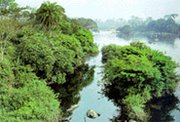 Taï National Park. (Source: UNESCO World Heritage Centre)
 Declared as a 'Forest and Wildlife Refuge' in 1926 by the French administration. National park status on 28 August 1972 by Presidential Decree 75-545. Reduced by 20,000 hectares (ha) ('Réserve de faune du N'Zo') on 21 March 1973 by Decree 73-132. Redefined by Special Decree 77-348 of 3 June 1977 which added a 20,000bha buffer zone around the park. The area was part of a forêt classée under a decree of 16 April 1926, then part of a 425,000 ha réserve de faune under a decree of 7 August 1956. Internationally recognized as a Biosphere Reserve under UNESCO's Man and the Biosphere Programme in 1978 and inscribed on the World Heritage List in 1982.
Area
330,000 ha plus 20,000 ha buffer zone; contiguous to Réserve de faune du N'Zo (73,000 ha).
Land Tenure
Government.
Altitude
80 meters (m) to 623 m (Mount Nienokoue).
Physical Features
The park comprises an ancient sloping granitic peneplain. This is broken by several inselbergs formed from volcanic intrusions, including the Niénkoué Hills in the south. A large zone of schists runs south-west to north-east across the park, dissected in places by tributaries of the watercourses which run parallel to it. The soils are ferralitic of generally low fertility but there are more fertile gleysoils in the south.
Climate
There are two distinct climatic zones of an equatorial transitional type. Annual rainfall ranges from a mean of 1,700 millimeters (mm) in the north to 2,200 mm in the south, reaching a peak in June with a shorter wet season in September, followed by a marked dry season from December to February. There is only a small temperature range of 24°C-27°C due to oceanic influence and the presence of forests. The relative humidity is high (85-90%). In 1986 the entire Côte d'Ivoire area suffered a 30% rainfall deficit, possibly due to extensive loss of forest cover.
Vegetation
The park is one of the last remaining portions of the vast primary forest that once stretched across present-day Ghana, Côte d'Ivoire, Liberia and Sierra Leone, and is the largest island of forest remaining in West Africa. There is a gradation from north to south, with the southern third of the park being the moistest and richest area, especially of leguminous trees. This humid tropical forest has a high level of endemism with over 150 species (16%) identified as endemic to the Taï region. The park contains some 1,300 species of higher plants of which 54% occur only in the Guinea zone. Vegetation is predominantly dense evergreen ombrophilous forest of a Guinean type characterized by tall trees (40 m-60 m) with massive trunks and sometimes large buttresses or stilt roots. Large numbers of epiphytes and lianes form an important element in the lower horizons including Platycerium spp., Nephrolepis biserrata, Drymaria sp. and Asplenium africanum. Two types of forest can be recognized: the poorer soils of the north and south-east support species such as palm Eremospatha sp., ebony Diospyros mannii (Q), Parinari sp., Chrysophyllum perpulchrum (Q) and Chidlowia sanguinea; and the 'Sassandrian' forest in the south-west, dominated by water-demanding species such as ebony Diospyros spp. and Mapania spp. with numerous endemic species, especially in the lower Cavally Valley and the Meno and Hana depressions near Mont Niénokoué. Gilbertiodendron splendidum occurs in the swamp forest. Plants which were thought to be extinct such as Amorphophallus staudtii have been discovered in the area. Since commercial timber exploitation ceased in 1972, the forest has recovered well.
Fauna
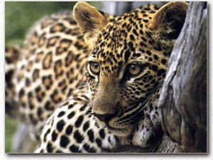 Leopard, Panthera pardus. (Source: Davidson University)
 The fauna is fairly typical of West African forests and the park contains 47 of the 54 species of large mammal known to occur in Guinean rain forest including five threatened species. Mammals include: mona monkey Cercopithecus mona, white-nosed monkey C. nictitans and diana monkey C. diana, black and white colobus Colobus polykomos, red colobus C. badius and green colobus Procolobus verus (V), sooty mangabey Cercocebus torquatus, chimpanzee Pan troglodytes (V) of which there are 2,000-2,800 in Taï, giant pangolin Manis gigantea, tree pangolin M. tricuspis and long-tailed pangolin M. tetradactyla, golden cat Felis aurata, leopard Panthera pardus, elephant Loxodonta africana (V) which may now number only 100 individuals compared to some 1,800 in 1979, bushpig Potamochoerus porcus, giant forest hog Hylochoerus meinertzhageni, pygmy hippopotamus Choeropsis liberiensis (V) (the only viable population remaining in the Côte d'Ivoire), water chevrotain Hyemoschus aquaticus, bongo Tragelaphus euryceros, buffalo Syncerus caffer and an exceptional variety of forest duikers including Jentink's duiker Cephalophus jentinki (E), banded duiker or zebra antelope C. zebra, Ogilby's duiker C. ogilbyi, black duiker C. niger, bay duiker C. dorsalis, yellow-backed duiker C. sylvicultor and the royal antelope Neotragus pygmaeus. Forest rodents include Lophuromys sikapusi, Malacomys edwardsi and Graphiurus murinus. Also recorded in the park is Stochomys defua, which is characteristic of secondary forest. Over 230 bird species have been recorded, 143 typical of primary forest, including white-breasted guineafowl Agelastes meleagrides (E), Nimba flycatcher Melaenornis annamarulae (I), western wattled cuckoo-shrike Campephaga lobata (V), and yellow-throated olive greenbul Criniger olivaceus (V). More details about birds are given in Thiollay. Almost 1,000 species of vertebrate have been identified.
Local Human Population
There are two main groups of inhabitants in the area, the rural Bakoué and Kroumen on the forest edge with only marginal impact on the forest, and the Baoule who are responsible for most of the forest destruction.
Visitors and Visitor Facilities
Visitor facilities are proposed in only one zone near Djiroutou which comprises mainly secondary forest resulting from previous forestry and agricultural activities.
Scientific Research and Facilities
The park is the site of a MAB project on the effects of human interference within the natural forest ecosystem. This is a vast research project carried out under the auspices of the University Institute for Tropical Ecology, and there is international scientific cooperation as exemplified by the Ivoirian, French, Italian, German and Swiss teams which have worked together on various research programs. The site and research project have great potential for training and scientific study. ORSTOM has worked here for a number of years. There is some Ivorian research into forest termites. It is included as a project under IUCN/WWF Plants Campaign 1984-1985. In 1984 there was a Dutch team surveying the area, using an ultra-light aircraft to photograph low altitude in order to identify dying trees for use as timber. From 1979 to 1985, Swiss researchers were studying chimpanzees. There is an ecological station in Andrenisrou basin in the core zone and the Federal German team base at Fedfo camp in the buffer zone. There is also a MAB station 18 km south-east of Taï village, which consists of several prefabricated houses, a communal kitchen, two well-equipped laboratories, and an electric generator. It is controlled and financed nationally and managed by two-three Ivorian personnel.
Conservation Value
This is one of the last important remnants of the primary tropical forest of West Africa. Its high floral diversity and the occurrence of several threatened monkey species are of great scientific interest.
Conservation Management
The park is almost completely surrounded by a buffer zone, the Taï Zone de Protection, of about 5 km width, which has the legal status of a managed fauna reserve. Here, agriculture is allowed, but new plantations or any settlement are theoretically prohibited. To the north, the Réserve de faune du N'Zo acts as a buffer. Taï Forest itself is under the responsibility of the Minister of Forests. There is a management plan for the area. Timber concessions have been withdrawn from the large companies. The park was put forward as an example for a pilot project to demonstrate the national conservation strategy being prepared under IUCN/WWF Project 3207. In the light of a major ministerial reorganization in late 1983 and the abandonment of the proposed Soubré dam scheme, further work on this project has been delayed. Taï is also the focus for IUCN/WWF Project 3052, which will provide support towards implementation of the management plan and purchase of a four-wheel drive vehicle, five motorbikes, a motorboat, radio telephones, and other essential equipment.
Priority management activities under WWF Project 3207 are to increase both the size and regularity of patrols within the park; seek recognition of the park's judicial status by local courts; seek removal of illegal farmers in the buffer zone and gold miners within the park; and pursue an education and public awareness campaign. In July 1988, the authorities decreed that existing plantations within the park could continue operating for a further three years, but that at the end of this period, they would be destroyed and no new plantations would be tolerated. The January 1988 aerial survey also revealed that bulldozed perimeter track was generally respected, whereas perimeters marked by only a 5 m-wide cut were not. Proposals have been made by the Ministère des Eaux et Forêts to include the Reserve de faune du N'Zo, intact primary forest to the south and a stretch of intact forest between the Meno River and current buffer, within the national park.
Management Constraints
The principal problems are poaching, logging, farming and illegal gold-mining. Insufficient funding has lead to inadequate training, equipment and research. In the northern part, 70,000 ha are temporarily ceded for exploitation. Aerial surveys, completed in January 1988, have revealed increasing degradation of the forest. Although the forest cover in the interior of the park is satisfactory, the buffer zone is severely degraded in parts and the east of the park has been heavily encroached. Planters show little respect for the buffer zone, although they generally observe the official boundaries of the national park. The west of the park is less severely encroached and large areas in the south, south-west and part of the north, adjacent to the protection zone, are still untouched. It was reported in 1983 that the south-west was becoming less isolated due to construction of roads providing access for poaching and illegal felling. Encroachment by timber companies, which was previously most severe in the north, has ceased, and forest is regenerating. However, gold panners are still in evidence, largely in the watershed system of Hana and Little Hana, clearing large areas of forest in the low-lying zones along the backwaters for their prospecting digs. Slash and burn agriculture has encroached into the buffer zone. Timber exploitation remains a potential threat both in the buffer zone and in the park, particularly in the north and along the road bordering the southern boundary where extensive felling is taking place. Theoretically, this is a forêt classée, but vast blocks are being clear-felled with an enormous waste of timber. Crops such as cocoa, coffee, maize, coco yam, sweet potato and okra are then planted, with cash crops taking up more and more land. Since independence, this region has become the principal producer of rough timber. A perimeter road designed to define the boundaries and make protection more effective has had the reverse effect, opening up significant portions of the park to timber contractors, shifting cultivators and poachers. In 1977, there were said to be many elephants, conspicuous even in the buffer zone. Now only a few remain, probably due to a combination of disturbance and poaching, which has increased dramatically in recent years, due to a lack of effective protection. Species taken include elephant for ivory, monkeys and antelopes for food and crocodile and leopard for skins. The park has also been severely affected by gold panning activities in the central region. The Soubré dam scheme has now been abandoned. This would not only have affected people who would have been uprooted but would also have affected the local economy and the environment, and Taï would have suffered by the displacement and influx of people to which it would give rise. The development of a management plan by WWF/IUCN has been hampered due to a major ministerial reorganization in late 1983 in the Côte d'Ivoire government, such that responsibility for the park has been splintered amongst several Regional Directors of Agriculture.
Staff
About 100 staff from the Ministry of Water and Forest Resources plus members of the University Institute of Tropical Ecology (undated information).
Budget
1981-1985 - 100 million francs CFA. 1982 WWF Tropical Forest Campaign funding - US$127,350. WWF Funding 1982/1983 (Project 3207) - US$5,098. WWF funds totaling SFr850,000 (US$ 530,000) have been earmarked for the purchase of vehicles; a three-year management expert contract; boundary demarcation; and an education and awareness program during 1988-1989. A similar sum is being provided by the government over the same period.
IUCN Management Category
- II (National Park)
- Biosphere Reserve
- Natural World Heritage Site - Criteria iii, iv
Further Reading
- Ake Assi, L. and Pfeffer, P. (1975). Inventaire Flore et Faune du Parc National de Taï. Abidjan. BDPA/SEPN.
- Boesch, C. (1989). West African Oasis. WWF Report August/September. Pp. 11-14.
- Budelman, A. and Zander, P.M. (1990). Land-use by immigrant Baoule farmers in the Tai Region, Southwest Ivory Coast. Agroforestry Systems 11(2): 101-124.
- Dosso, M., Guillaumet, J.L. and Hadley, M. (1981). Taï Project: Land Use Problems in a Tropical Rain Forest. Ambio 10(2-3): 120-125.
- FGU-Kronberg, (1979). Etat actual des Parcs Nationaux de la Comoé et de Taï. Tome 3. Parc National de Taï. Deutsche Gesellschaft für Technische Zusammenarbeit (GTZ) GmbH., Abidjan. 155 pp.
- Guillaumet, J.L., Couturier, G. and Dosso, H. (1984). Recherche et aménagement en milieu forestier tropical humide: Le Projet Taï de Côte-d'Ivoire. Unesco, Paris.
- IUCN (1982). Rapport de Mission UICN/WWF/PARCS CANADA - Côte d'Ivoire (Parc National de Taï). IUCN, Gland.
- IUCN (1985). Threatened Natural Area, Plants and Animals of the World. Parks 10: 15-17.
- IUCN/WWF Project 3052. Ivory Coast, Tropical Rainforest Campaign.
- IUCN/WWF Project 3207. Development Plan for Taï National Park.
- Lauginie, F. (1975). Etude de milieu naturel et de l'environnement socio-economique du Parc National de Taï. BDPA/SEPN, Abidjan.
- Poorter, L., Jans, L., Bongers, F., van Rompaey, R. (1994). Spatial distribution of gaps along three catenas in the moist forest of Tai National Park, Ivory Coast. Journal of Tropical Ecology 10(3): 385-398.
- Rahm, U. (1973). Propositions pour la création du parc national ivoirien de Taï. Morges, Switzerland: IUCN Occ. Paper No. 3.
- Roth, H.H. (1982). We all want trees: Resource Conflict in the Taï National Park Ivory Coast. Proceedings of the World National Parks Congress held in Bali, Indonesia. 11-22 October 1982.Roth, H.H., Merz, G. and Steinhauer, B. (1984). Distribution and status of large mammals in Ivory Coast. 1. Introduction. Mammalia 48(2): 207-226.
- Thiollay, J.M. (1985). The Birds of the Ivory Coast: Status and Distribution. Malimbus 7: 1-59. World Heritage Nomination submitted to Unesco.
| Disclaimer: This article is taken wholly from, or contains information that was originally published by, the United Nations Environment Programme-World Conservation Monitoring Centre (UNEP-WCMC). Topic editors and authors for the Encyclopedia of Earth may have edited its content or added new information. The use of information from the United Nations Environment Programme-World Conservation Monitoring Centre (UNEP-WCMC) should not be construed as support for or endorsement by that organization for any new information added by EoE personnel, or for any editing of the original content. |
1 Comment
Peter Howard wrote: 02-02-2011 19:56:30
Readers may want to visit the African Natural Heritage website to view a selection of images and map of the Tai National Park world heritage site, and follow links to Google Earth and other relevant web resources: http://www.africannaturalheritage.org/Tai-Forest-National-Park-Cote-Divoire.html