Paracel Islands
| Topics: |
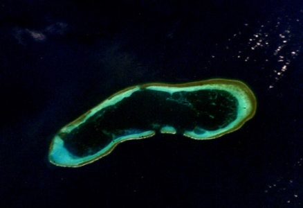
Discovery Reef, one of the Paracel Islands. Source: NASA
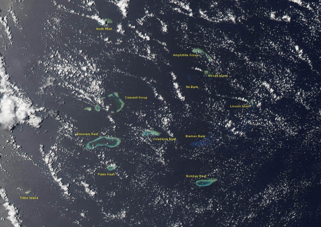
Countries and Regions of the World Collection  The Paracel Islands are a group of small islands and reefs in the South China Sea, about one-third of the way from central Vietnam to the northern Philippines.
They are composed of 130 small coral islands and reefs divided into the northeast Amphitrite Group and the western Crescent Group
The islands are uninhabited but for scattered Chinese garrisons
|
|
|
|


In 1932, French Indochina annexed the islands and set up a weather station on Pattle Island; maintenance was continued by its successor, Vietnam.
China has occupied all the Paracel Islands since 1974, when its troops seized a South Vietnamese garrison occupying the western islands. China built a military installation on Woody Island with an airfield and artificial harbor.
The islands also are claimed by Taiwan and Vietnam.
The islands have the potential for oil and gas development. Waters around the islands support commercial fishing, but the islands themselves are not populated on a permanent basis.
Location: Southeastern Asia, group of small islands and reefs in the South China Sea, about one-third of the way from central Vietnam to the northern Philippines
Geographic Coordinates: 16 30 N, 112 00 E
Area: 7.75 sq km
Coastline: 518 km
Terrain: mostly low and flat. The highest point is an unnamed location on Rocky Island 14 m
Climate: tropical
Population: no indigenous inhabitants. Note: there are scattered Chinese garrisons

Spratly and Paracel Islands. Source: NASA World Wind/Wikimedia Commons