Precipitation detection
Synopsis
This page is maintained by the Precipitation Detection Working Group of the PMM Science Team. The purpose is to document current and proposed methods for detecting precipitation on a global basis utilizing the space-borne active and passive microwave sensors planned for the Global Precipitation Mission (GPM).
Introduction
Motivation
Precipitation detection (PD) is often, but not always, regarded as the first essential step in the estimation of precipitation from remote sensing platforms. The basic purpose of detection is two-fold:
- To make an initial determination of which sensor pixels may contain precipitation, so that a more sophisticated rain rate retrieval algorithm may be brought to bear on those pixels while
avoiding unnecessary computational effort elsewhere.
- To prevent the retrieval algorithm from attempting retrievals in situations where it is likely give spurious false-positives; e.g., due to problem background types.
Formal Statement
Although detection is traditionally regarded as a binary classification problem, it must be recognized that this is strictly for convenience, driven in large part by the binary decision of whether or not to apply a retrieval algorithm. In reality, the sensor data obtained for a particular scene should be viewed as having the potential to yield probabilities with respect to the occurrence of precipitation exceeding some threshold.
where  is the probability of
  given the vector of observations
  . When implementing a particular binary detection algorithm, one is effectively defining a boundary in -space. This boundary in turn translates into a functional relationship between the threshold rain rate
  and a threshold probability leading to the classification of the pixel as "precipitating." Depending on the application, one might prefer a detection screen that is conservative (only "definite precipitation" is flagged) or liberal (detection allows "possible precipitation").
Relationship to Estimation Problem
It is extremely important to recognize that there is, in fact, no unique division between the detection and estimation problems. Both tasks require the discrimination between variations in observables (e.g., brightness temperature) due to precipitation and those due to other background variables, such as surface emissivity, column water vapor and/or cloud water, temperature, etc. Indeed, a retrieval algorithm that is sufficiently skillful at separating precipitation signatures from other signatures may simply retrieve a precipitation rate everywhere without prior screening: where the retrieved value exceeds the minimimum detectable amount (which is never zero), the pixel is classified a posteriori as precipitating; all others have their value set to zero.
It should be further noted that precipitation detection algorithms are not necessarily "plug-compatible" with all preciptation retrieval algorithms. Typically, the two components work in partnership; the retrieval component implicitly assumes something about the quality and nature of the pre-screening by the detection algorithm.
Phase Classification
Closely related to the detection problem is the classification of precipitation by phase (e.g., snow vs. rain). Again, this classification may be either prior or posterior to the estimation of precipitation rate:
- Given that a non-zero precipitation rate was retrieved, what is the likely phase at the surface? Or,
- Given that a pixel may contain precipitation, should a rainfall or snowfall retrieval algorithm be applied to that pixel?
There is no "correct" order; the decision depends on the nature of the algorithm. The second approach becomes effectively mandatory only when there are significant differences between the algorithms employed for rainfall vs. snowfall retrieval.
Furthermore, the classification of phase may follow either directly from information gleaned from the satellite observations themselves or from ancilliary data (e.g., operational analyses of near-surface air temperature). The first approach is perhaps inherently more difficult, but it has the advantage of being immune to errors in the analysis fields. This is of particular concern over remote regions of the globe where conventional data are sparse (though less so than would have been the case prior to routine assimilation of satellite sounder data).
Passive Microwave Detection of Precipitation
Branching According to Scene Type
For space-based passive microwave (PMW) retrieval algorithms, the detection/retrieval problem has historically been subclassified according to precipitation phase and surface type. In order of increasing difficulty, these are
- Rain over ocean
- Rain over land
- Snow over ocean
- Snow over land
These classifications are again somewhat arbitrary for two reasons: (1) snow that melts just meters above the surface and therefore reaches the surface as rain may be radiometrically indistinguishable from snow reaching the surface, and (2) both 'land' and 'ocean' backgrounds encompass a wide variety of radiometrically distinct surface types, not to mention variable admixtures of these types within a single pixel. One could therefore envisage additional subclassifications, such as sea ice, coast, sand, etc. Regardless, an important goal of any detection scheme should be to be relatively insensitive to uncertainties in underlying surface type.
Rain over ocean
Rain over ocean is the simplest case, because the warm, unpolarized emission from rainfall contrasts strongly with the cold, polarized emission from the surface. The primary problems of detection are (1) the lack of a spectrally distinct signature between non-precipitating cloud and liquid precipitation, and (2) partial filling of the field of view. In the first instance, the most common solution is to define an ad hoc threshold of non-precipitating column cloud liquid water (CLW), beyond which any emission is assumed to be due to liquid precipitation. Recent work by Liu and others suggests that any such threshold should depend on the environment (e.g., freezing level height). Regardless of such refinements, it is clear that no ad hoc CLW threshold will be satisfactory in all cases, as the correct threshold likely depends on precipitation efficiency (in warm cloud cases), which in turn depends on environmental properties (e.g., CCN concentrations) that cannot be easily measured.
Rain over land
The principle problem with rainfall detection over land lies in the relatively warm, relatively unpolarized nature of land surface emission. Thus, the signature of liquid precipitation may be very weak (or even non-existent) against this background. Moreover, land surface emission varies more radically, both in time and in space, than ocean emission, further reducing the signal-to-noise ratio.
As a result of the above problems, over-land detection algorithms rely primarily on the detection of the cold, relatively unpolarized signature of scattering by snow aloft against the warm, relatively unpolarized background. This detection method fails, of course, in the case of warm-cloud precipitation possessing no significant ice phase.
To further improve the detection skill over land, one may attempt to reduce the background "noise" level by specifying a time- and location-dependent background brightness temperature or emissivity. These may be based on climatologies or retrieved directly from the satellite observations (e.g., using lower frequency channels).
Snow over ocean
It is sometimes assumed that passive microwave methods cannot reliably detect snowfall over ocean. Indeed, a common failure of many ocean algorithms lies in their apparently inability to detect snowfall. However, this failure is not universal and therefore cannot be ascribed to a fundamental limitation of passive microwave radiometers, as long as polarization information is available. Petty has shown that reasonably successful detection and retrieval of monthly snowfall amounts is possible over the high-latitude oceans, as illustrated by high correlations (including during winter months) of AMSR-E retrievals with surface gauge measurements at Jan Mayen Island.
Snow over land
Since the detection of rain over land usually relies on the detection of an ice signature aloft, the detection problem for snow over land is distinguished primarily by the likelihood of snow cover on the ground, which radically alters the surface emissivity and makes it radiometrically almost indistinguishable from falling snow. The only solutions that are known to be currently under development entail the use of "surface blind" sounding channels (e.g., from AMSU) whose weighting functions peak low enough in the troposphere to detect falling snow but not so low as to be easily confused by surface snow cover.
Historical Approaches
Rain over Ocean
- RSS: retrieve
 first, Rain if
 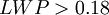 mm.
mm.
- GPROF: retrieve LWP and freezing level height first, flag as rain if
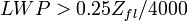 and
and  K.
K.
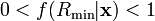
- Petty (1994a,b): Classify high-resolution (e.g., 89 GHz) pixels as "possible precipitation" based on
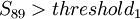 or
or 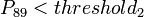 .
.  is a scene-dependent linear combination of the 89 V and H channels (generalized from Spencer's
  ) and is designed to optimally separate cold, highly polarized ocean surface emission and cold, less-polarized signatures of scattering by snow aloft. The threshold used is approximately 8 K and was empirically chosen to maximize skill in the delineation of radar-detected wintertime precipitation over Wakasa Bay. Note that the
  threshold used equates to an assumed maximum for non-precipitating clouds. This threshold has been empirically adjusted to optimize global precipitation fraction but does not currently depend on region or other variables.
- Liu: Background
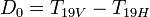 and
and  (85GHz) is computed
for 3x6 deg. monthly using 92/93 SSM/I data. Use Petty’s  as
threshold when computing
as
threshold when computing  and . Rain if obs of
  and satisfy
  .
.
Rain over Land
- Ferraro: Rain if Scattering Index (
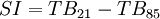 ) exceeding a
threshold (8K); the threshold is derived empirically, Also use TMI-PR matchups to determine Convective/Stratiform fraction
- Liu: Background scattering index (
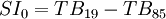 ) is computed for each 3x6deg. monthly using 92/93 ssm/i data. Rain if obs
 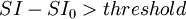 (also 8 K)
- Conner and Petty (1998): A gridded monthly climatology of mean brightness temperature is created. This climatology is subtracted from individual overpasses to yield anomalies in all channels. The multi-channel anomalies are projected onto a vector that is orthogonal to variations due to surface wetness and temperature; that scalar value is then empirically scaled to precipitation rate with a detection threshold that is chosen to optimize the Heidke Skill score relative to radar-detected precipitation.
Snow over Ocean
- Petty: Same as for rain over ocean.
- Johnson: Ku/Ka band radar signal -> assume precipitation, compare with sounding data to determine freezing level. Only works when radar co-located with radiometer. Will be expanded to non-radar areas using nearby radar information to help constrain unknowns. Currently HF PMW channels used to constrain radar retrieved properties, but doesn't affect PD.
- Noh: Using HF, find background TB0 for
 deg monthly. Snow if
  . Doing the same for over land.
Snow over Land
- Skofronick-Jackson: HF channels to detect scattering signature of snow events (details?)
- Wang, N-Y.: HF / channel difference discrimination (details?)
Ongoing Development and Validation Strategies
Comparisons With Radar
Active Microwave (Radar) Detection of Precipitation
Equation environment example (uses LaTeX):
| | Completion status: this resource is ~25% complete. |
| | Subject classification: this is a science resource . |
| | Subject classification: this is a physics resource . |
References
Conner, M.D., and G.W. Petty, 1998: Validation and intercomparison of SSM/I rain rate retrieval methods over the continental United States. J. Appl. Meteor., 37, 679-700.
Petty, G.W., 1994a: Physical retrievals of over-ocean rain rate from multichannel microwave imagery. Part I: Theoretical characteristics of normalized polarization and scattering indices. Meteorol. Atmos. Phys., 54, 79-100 PDF version
Petty, G.W., 1994b: Physical retrievals of over-ocean rain rate from multichannel microwave imagery. Part II: Algorithm implementation. Meteorol. Atmos. Phys., 54, 101-122 scanned PDF version
See also
- Precipitation (Wikipedia)